
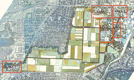
V.5 - Demonstration Plan
Once the Management Plan had been developed to a point that gave clear written direction to the future of the Farm, it was decided that it would be prudent to graphically illustrate the implications of the primary directions that were set. A Demonstration Plan was developed to provide a clear indication how the general structure of the Central Experimental Farm might appear after the implementation of some of the key recommendations. This Demonstration plan is intended to be a reflection of one approach and it should be pointed out that, while this approach represents a possible future for the site, it is not the only one that would be consistent with the Plan.
The Demonstration Plan illustrates the Recommended Concept and its vision "to sustain a cultural landscape of national historic significance through a reinvigorated and ongoing agricultural research program".
Illustrative Site Plan [Source: PFS]
The Plan illustrates a re-invigorated research option that allows the AAFC to expand and develop its research activities, while respecting and reinforcing the Farm's value as described in the Parks Canada Commemorative Integrity Statement. The Plan creates a physical form that makes research activities more public and interactive, thus returning the Farm closer to its original design intentions. It also maintains opportunities for existing programs including the Museum and the Arboretum.
This Demonstration Plan includes a comprehensive site layout showing the fundamental structure of the farm. This is supported and enhanced by area enlargement plans and vignettes.
The key elements illustrated in the plan include: expansion of research facilities in the vicinity of Carling Avenue and a reorganization of site access at this location; expansion of the wooded shelterbelt along the north and west boundaries; integration of the new headquarters site at Baseline and Merivale into the overall farm; redevelopment of the Sir John Carling building; clarification of the more public central areas; streetscape and traffic circle improvements along Prince of Wales Drive.
Area 1
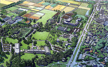
The plan illustrates the expanded research campus in the area of the existing Neatby Building. It indicates a distinct new entrance from Carling Avenue creating new patterns of vehicle and pedestrian circulation. It shows possible new building sites, a modern greenhouse complex and other laboratory functions, organized within a campus- like setting that consolidates and clarifies the core function of the site.

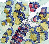
Overhead Perspective, Area 1 [Source: PFS]
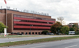
K.W. Neatby Building [Source: AAFC]
Enlarged Area Plan - Research Campus [Source: PFS]
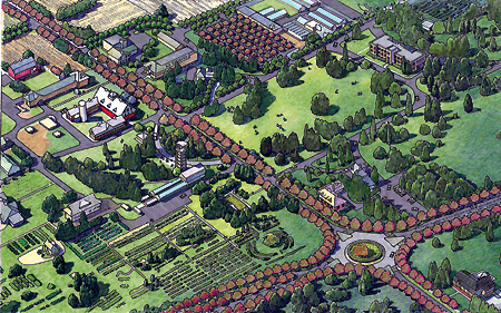
Area 2
The plan illustrates an adaptive reuse of the Sir John Carling Building, as the Headquarters has shifted to a new location at the southwest corner of the site. The Sir John Carling Building site is illustrated as a visitor facility and a National Collections Centre where current agricultural research activities at the CEF and across Canada are accessible to the public. Meaningful links are created through the landscape to bind the public interpretation area to the Arboretum and Ornamental Gardens, a new Policy Research Institute, the Observatory campus, and to the Canada Agriculture Museum.
Overhead Perspective, Area 2 [Source: PFS]
Area Enlargement at Northeast Gateway [Source: PFS]
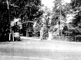
Gateway to the CEF, 1945 [Source: National Archives of Canada, PA-132971]
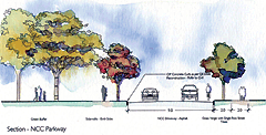
Area 3
The plan looks at the nature of Prince of Wales Drive and revives this corridor as a binding element, rather than a boundary between the Farm proper and the Arboretum and natural lands to the east. The plan returns the road profile closer to its original parkway geometry and adds graceful lines of trees. The plan also examines pedestrian circulation in order to provide safer access along and across the corridor.
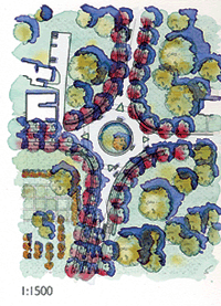
Area Enlargement of Traffic Circle at Prince of Wales Drive [Source: PFS]
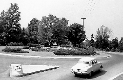
Traffic Circle on Prince of Wales Drive, 1948 [Source: National Archives of Canada, PA-131604]
Demonstration Plan Sections [Source: PFS]
The plan also looks at the nature of the N.C.C. driveway and its impact on the central portion of the Farm. The elimination of bus facilities along the north side of the Museum and a more general return of the parkway features are intended to contribute to a more legible and coherent pattern in this area.

Demonstration Plan Sections [Source: PFS]
Area 4
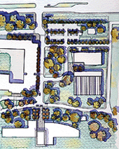
The plan illustrates modest landscape redevelopment in the central campus area, which includes shared public facilities for the Museum and Arboretum and Ornamental Gardens. It is envisioned that conference facilities would be established in a number of the key heritage buildings within the central campus and that a new Agricultural Policy Institute would be located in a converted Saunders Building. The Canada Agriculture Museum stays on in its current location with assumed modifications to this ticketed venue. The plan also assumes the continuation of tenancy in a variety of existing heritage buildings within the central campus area that have long been associated with other public and private agricultural agencies. A consolidated parking area to service many of these uses has been centrally located for easy access. The parking area is incorporated within a new bosque of trees and surfaced with permeable paving to enable ground water recharge.
Overhead Perspective of Central Campus Area [Source: PFS]
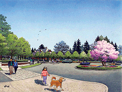
Perspective Sketch - Traffic Circle [Source: PFS]
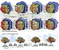
Demonstration Plan Parking Lot Sections [Source: PFS]
Area 5
The plan illustrates the new headquarters of the AAFC and its agencies at southwest corner of the Farm, just outside of its historic boundaries. This location will better serve the evolving headquarters function while still maintaining an intimate relationship with the Farm. This relocation will allowing potential redevelopment of Sir John Carling Building area for public and collections functions and will anchors this corner of the site against any future encroaching development. The landscape treatment surrounding the headquarters site is intended to reinforce the relationship between the new Headquarters Campus and the cultural landscape of the CEF.
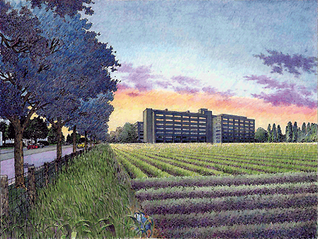
Perspective Sketch - Western View Towards Headquarters Campus [Source: PFS]
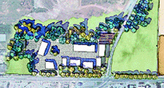
Area Enlargement - Headquarters Campus [Source: PFS]
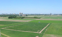
View of ECORC Fields from Headquarters Campus [Source: Contentworks, 2003]