II.4 - Current Policy and Planning Context
Agriculture and Agri-Food Canada Policy Framework
Putting Canada First is an Agriculture Policy Framework (APF) developed by AAFC in 2002. The APF is based on five key elements: food safety and food quality; environment; science and innovation; renewal; and business risk management. It provides a framework for all AAFC programs, including those of research centres such as ECORC. The APF commits government to working with producers and others to address growing environmental concerns by helping farmers adopt environmentally sustainable practices. The CEF Management Plan is consistent with the APF in its proposal that AAAF use the CEF as an instrument for scientific understanding of linkages between natural ecosystems and agricultural production, of agricultural production in an urban context, and of reforestation of urban areas.
Other Federal Policies and Initiatives
Results for Canadians: A Management Framework for the Government of Canada is a management framework created by Treasury Board in 2002. Its goal is to modernize government management by responding to changing priorities and expectations. Current initiatives include improving citizen access to services and customer satisfaction, giving reliable access to on-line services, ensuring modern comptrollership, improving reporting to Parliament, ensuring integrity of existing programs and developing a workplace that fosters leadership and participation. The CEF Management Plan is consistent with these initiatives.
Canada's Urban Strategy: A Blueprint for Action was released by the Prime Minister's Caucus Task Force on Urban Issues in 2002. The task force's mandate was to find ways of working collaboratively to strengthen the quality of life in large urban centres. The final report emphasized urban renewal, sustainable design and the importance of using federal land to advance federal policies. The task force noted the importance of protecting green spaces within urban regions, of preserving heritage buildings and historic sites, and of developing strong urban partnerships between and among all orders of government. The CEF Management Plan advances these priorities.
Canada's Innovation Strategy was launched by Industry Canada in 2002, with the release of two documents: Achieving Excellence: Investing in People, Knowledge and Opportunity and Knowledge Matters: Skills and Learning for Canadians. The innovation strategy challenges the government of Canada to improve scientific and technical education in Canada, to establish new partnerships that support innovative endeavours, and to integrate scientific programs, where possible, across departmental boundaries. The CEF Management Plan is consistent with and supportive of these goals.
The Historic Places Initiative launched by Canadian Heritage in 2000 commits the federal government to a more proactive treatment of historic places across the country. It is a partnership agreement with the provinces and territories and is expected to lead to the introduction of legislation late in 2003. Of particular significance to the CEF is the commitment by Canadian Heritage to support other federal departments in their protection and enhancement of designated National Historic Sites. The Farm is one of the pre-eminent National Historic Sites in federal custody and the CEF Management Plan is consistent with the goals of the Historic Places Initiative and the conservation standards and guidelines that have been developed to support it.
Urban and Regional Planning Context
The Central Experimental Farm National Historic Site is affected by a number of overlapping federal, provincial and municipal land use planning policies. The recent adoption of the City's 2003 Official Plan has eliminated one such document, the 1997 Regional Municipality of Ottawa-Carleton Official Plan. However, four main federal and municipal planning documents will continue to provide land use planning guidance for the CEF lands. These include the National Capital Commission's Plan for Canada's Capital (1999); Parks Canada's Rideau Canal Management Plan (1996), to be replaced by the (draft) Rideau Canal National Historic Site Management Plan; and the City of Ottawa Official Plan (2003) with related master plans and strategic growth management plans. The City of Ottawa Zoning By-Law also sets out certain land use regulations affecting the CEF lands.
National Capital Commission's Plan for Canada's Capital
For jurisdictional reasons, the lead planning document for land use decisions affecting CEF lands is the NCC's Plan for Canada's Capital (PFCC). It sets out the federal government's goals for use of federal lands in the National Capital Region. The NCC reviews all proposals for the use of federal lands for conformity with this Plan through the Federal Land Use & Design Approvals and Land Transactions processes.
The PFCC contains broad, high-level policies that place the CEF within the context of other federal lands in the National Capital Region, identifying the lands east of Prince of Wales as Capital Urban Green Space, the Rideau Canal and nearby CEF shore lands as Waterway and Shore Land, the Canada Agriculture Museum lands as National Cultural Institution, the research fields as Rural Lands, and the lands near Carling as Federal Node. In the context of this plan, the CEF's role as a National Historic Site and a cultural landscape of national historic significance underlies all its other federal land use roles. The PFCC also adopts the FHBRO Code of Practice while providing broad guidance for interpretation and visitor experiences. In accordance with the "Archaeological Resource Potential - Federal Lands in the NCR" map (1998), the PFCC sets out requirements for CEF lands identified as having medium and high archaeological resource potential.
The PFCC further designates several roadways situated both within, and connecting with the CEF. Prince of Wales Drive north of the traffic circle and the NCC Driveway are designated Capital Parkway, connecting with Queen Elizabeth Drive on the east and Island Park Drive on the northwest. The PFCC designates Prince of Wales Dr. south of the traffic circle as Scenic Entry, matching the designation in the City of Ottawa Official Plan. Due both to the connectivity of Prince of Wales Drive with the NCR federal Capital Parkway system, and the potential of this roadway to sever historic and contemporary landscape and land use patterns within the National Historic Site, the CEF National Historic Site Management Plan establishes design guidelines for Prince of Wales Drive as an urban parkway within the CEF boundaries.
The PFCC also designates recreational paths running through the CEF as part of the Capital Pathway Network, requiring the implementation of a number of design, maintenance, safety and signage standards and guidelines contained in the "Integrated Network of Recreational Pathways for the NCR" report. The NCC coordinates implementation of the latter with the City of Ottawa through its planning approval processes. The CEF Management Plan establishes guidelines for the CEF recreational pathway system that differ in some respects from the NCC and City of Ottawa standards to ensure that the design and treatment of these paths are consistent with the historic landscape setting and character of the CEF National Historic Site. See section V.4 Paths.
The CEF National Historic Site is designated in its entirety as part of the National Interest Land Mass. These lands are essential for the long-term symbolism, functions, physical structure, and natural and cultural landscape qualities of the Capital. Implicit in a NILM designation is a formal expression of the Federal Government's interest in the long-term use of these lands. Most NILM lands are, or should be, under the custody of the federal government to ensure they are protected and enhanced. Generally, the majority of these lands is, or will be, owned by the NCC, while some NILM lands will also be under the custody of other federal custodians or departments.
Rideau Canal National Historic Site of Canada Management Plan
A draft Rideau Canal National Historic Site of Canada Management Plan is awaiting approval, replacing the 1996 Rideau Canal Management Plan. The stated purpose of the draft plan is to ensure the commemorative integrity of the Rideau Canal National Historic Site. The plan assumes that all levels of government have a role in protecting the heritage character of the Canal, although it looks mainly to municipal governments as the key partners in achieving the vision.
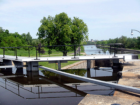
Hartwell Locks, 2003 [Source: Contentworks]
Parks Canada's Rideau Canal Management Plan serves as a key land use planning document for lands situated in the immediate vicinity of the Rideau Canal National Historic Site, i.e. CEF lands abutting Dow's Lake and the Rideau Canal. In particular, back shore land use and development is expected to protect open space and ensure compatible activities with the historic character of the Canal. Views to the Canal from the Arboretum and from other lands east of Prince of Wales Drive are also to be protected. In addition, the Rideau Canal management plan guides any land use activities in the vicinity of the Hartwell Locks, the Lockmaster's House, and the Hartwell Lock station landscape, all of which are identified as Level 1 resources in the Rideau Canal Commemorative Integrity Statement.
City of Ottawa Official Plan and Zoning By-Law
In order to ensure compatibility with, and respect for, the municipal planning process policies in the City of Ottawa Official Plan and regulations in the City of Ottawa Zoning By-Law are to be taken into account wherever possible. The document also afford further protection of the National Historic Site as a designated property.
The Official Plan identifies the boundaries of the CEF as a national historic site and cultural heritage resource. It requires proponents of development proposals or public works situated both in and adjacent to the CEF National Historic Site to prepare a cultural heritage impact statement which makes reference to the CEF Commemorative Integrity Statement. The Official Plan designates the experimental fields and most of the other CEF lands west of Prince of Wales Drive as Agricultural Research. The remaining lands west of Prince of Wales Drive are designated General Urban Area and Urban Natural Features. The Arboretum and other lands east of Prince of Wales Drive are designated Urban Natural Features and Major Open Space. The intent of the Urban Natural Features designation is to preserve the Arboretum and an adjacent open wetland next to the Canal, as well as the remaining 1880's shelterbelt east of Fisher Avenue. This intent is further implemented by an Environmentally Sensitive Area designation in the City of Ottawa Zoning By-Law.
It should be noted, however, that certain uses permitted by the General Urban Area designation for the lands abutting Carling Avenue, west of Prince of Wales, are not consistent with the achievement of the vision of the CEF Management Plan. This designation permits all types and densities of housing, as well as shopping, entertainment and industrial uses. The same concern applies to certain uses permitted by the equivalent Employment Centre Zone in the City's Zoning By-Law, e.g., apartment building, diplomatic mission, official residence.
The Official Plan sets out right-of-way requirements to be protected for urban arterials running through and adjacent to the CEF, such as Prince of Wales Drive between Preston and Baseline (26 metres), and Fisher Avenue between Carling and Baseline (34 metres). The draft Transportation Master Plan provides that consideration will be given to waiving or reducing such requirements where the widening would result in adverse effects, that can not be mitigated, on adjacent valued built heritage resources, natural heritage features, and other features deemed of significance to the City. The Plan designates the adjacent rail line next to Dow's Lake as Existing Rail Rapid Transit (O-Train), and Carling Avenue as Future Rail Transit and Transit Station Future Potential.
It should be noted that the Official Plan also identifies both Prince of Wales Drive and the Driveway as Scenic-Entry Routes, setting out certain criteria that apply for development applications adjacent to these routes. These criteria vary somewhat from the vision and some of the guidelines in the CEF Management Plan.
Transportation Planning Context
The following is a summary of the existing transportation planning context for the Central Experimental Farm, a process still being shaped by the new Transportation Master Plan which will form part of the City of Ottawa Official Plan.
The Central Experimental Farm represents a culturally sensitive landscape embedded within a mature transportation system. It is situated to the south of Highway 417 (the major east-west freeway within the City) and to the west of the Rideau Canal. It is bounded by well-established residential communities such as Carlington, and Courtland Park; health and academic institutions such as the Civic Campus of Ottawa Hospital and Carleton University; and parkland.
The following arterial roads and features define the approximate study area for purposes of the transportation review.
- Rideau Canal to the east
- Fisher Avenue and Merivale Road to the west
- Carling Avenue to the north
- Baseline Road to the south.
Existing Roads
The key road network elements that currently exist within the study area are summarized in Table 1. All of these roads are currently under the jurisdiction of the City of Ottawa.
| Road | Description | Current ROW Protection (1) | Proposed ROW (2) |
|---|---|---|---|
Notes:
|
|||
| Baseline Road | 4-lane east-west arterial, urban divided cross-section | 40m | 44.5m |
| Carling Avenue | 6-lane east-west arterial, urban divided cross-section | 40m | 44.5m |
| Merivale Road | 4-lane north-south arterial, urban divided cross-section | 34m | 37.5m (3) |
| Fisher Avenue | 2-lane north-south arterial, rural undivided cross-section | 34m | 37.5m |
| Prince of Wales Drive | 2-lane north-south arterial, rural undivided cross-section | 26m | 26m (3) |
Internal to the site are a number of local roads, the most notable of which is the NCC Driveway. It represents the southerly extension of Island Park Drive, and it transitions into an east-west roadway that terminates at Prince of Wales Drive (in the form of a traffic circle). The balance of the local roads and lane-ways provide access to the various building sites that define the CEF and/or function as key pedestrian/bicycle linkages. All internal site roads are currently under the jurisdiction of the NCC.
The local road network intersects the primary arterial road network at several key locations, including:
- Sir John Carling at Prince of Wales Drive: traffic signal
- McCooey Lane at Merivale Road (at Central Park North): no signal
- NCC Driveway at Prince of Wales Drive: traffic circle
- NCC Driveway at Island Park Drive/Holland Avenue: traffic signal
- Hartwell Locks at Prince of Wales Drive: traffic signal
- Maple Drive at Carling Avenue (at Irving Place): traffic signal
- McCooey Lane at Fisher Avenue: traffic signal
Table 2 provides a summary of existing conditions on area roads based on current intersection turning movement counts (obtained from the City of Ottawa) and field observation. The descriptive criteria for each road segment includes classification, number of lanes, posted speed limit, presence of a sidewalk and bicycle lane, transit routes and peak direction volume.
A traffic count was also carried out at the NCC Driveway / Maple intersection in October 2002 (see over page).
| Road Name and Section | Classification | Existing Conditions | |||||
|---|---|---|---|---|---|---|---|
| No. of vehicle travel lanes | Posted Speed (km/h) | Sidewalk | Bicycle Lane *designated route |
Transit Route | Peak Directional Volume (veh/h) | ||
| Baseline Road Merivale to Prince of Wales |
Divided arterial | 4 | 60 | South side | No | R118 P114 |
2,000 |
| Carling Avenue Hwy 417 to Booth |
Divided arterial | 6 | 60 | Both sides | No | R6 R85 R99 |
2,000 |
| Merivale Road Clyde to Baseline |
Undivided arterial | 4 | 60 | Both sides | No* | R176 | 900 |
| Merivale Road Baseline to Kingston |
Divided arterial | 4 | 60 | West side | No * | R151 R176 P114 R151 R176 |
1,200 |
| Merivale Road Kingston to Carling |
Undivided arterial | 4 | 50 | Both sides | No * | 1,200 | |
| Merivale Road Carling to Hwy 417 |
Undivided arterial | 2 | 40 | Both sides | No * | n/a | |
| Fisher Avenue Dynes to Carling |
Undivided arterial | 2 | 50 | West side | No * | R86 P57 |
1,000 |
| Prince of Wales Drive Dynes to Preston |
Undivided arterial | 2 | 60 | Partial | Yes * | R3 R175 |
1,500 |
| Preston Avenue Prince of Wales to Carling |
Undivided arterial | 4 | 50 | Both sides | No | R3 | 1,100 |
| Preston Avenue Carling to Hwy 417 |
Undivided arterial | 4 | 50 | Both sides | No | R3 | 800 |
| Parkdale Avenue Carling to Hwy 417 |
Undivided arterial | 2 | 50 | Both sides | No | R6 R14 |
600 |
| Holland Avenue Carling to Hwy 417 |
Undivided arterial | 2 | 50 | Both sides | No * | R176 R86 P55 P57 |
800 |
Off-Road Pedestrian and Bicycle Systems
There are numerous off-road facilities available to pedestrians and bicyclists adjacent to, and within, the CEF. These facilities complement the City of Ottawa's designated on-road system elements noted in Table 2. Adjacent to the grounds, several major off-road corridors exist, namely: the network to the east that is integrated within the Arboretum, Fletcher Wildlife Garden, and Carleton University (including the Hartwell Lock connecting crossing the Rideau Canal); and the NCC Pathway to the west that links various community parks such as Braemar Park and Bel-Air Park to the Southwest Transitway facilities. Internal to the CEF, one corridor within the central portion provides a linkage between the foregoing adjacent off-road networks, while another corridor parallels the NCC Scenic Driveway.
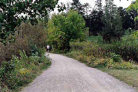
Pathway Network [Source: PFS]
Two-way pedestrian volumes on most arterial roadways within the study area are modest, ranging between 5 and 25 persons per hour. Two-way bicycle volumes on the major north-south roads, namely Merivale Road, Fisher Avenue and Prince of Wales Drive range between 20 and 45 bicycles per hour (summer counts). East-west bicycle volumes are observed to be quite high (50 bicycles per hour two-way) at the Prince of Wales/Hartwell intersection. Footnote 8
Transit Systems
The arterial road network that surrounds the CEF (i.e., Baseline Road, Carling Avenue, Merivale Road, Fisher Avenue, and Prince of Wales Drive) is well serviced by regular and peak period transit routes. Specific bus routes are noted in Table 2. The CEF is not located in close proximity to a dedicated Transitway corridor, although the O-Train pilot project does run north/south along the CP rail corridor located immediately to the east of the CEF. Nearby O-Train stations include one located at Carleton University (Carleton Station) and another located northwest of the Carling/Preston intersection (Carling Station).
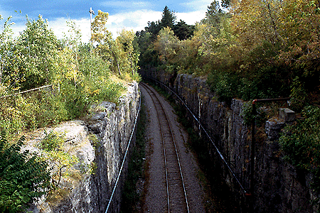
O-Train Cut [Source: PFS]
Opportunities and Constraints
Road Capacity
Arterial road capacities typically range between 800 veh/h and 1,500 veh/h per lane depending on the frequency of access opportunities. Within the CEF study area, Carling Avenue, Baseline Road and Merivale are divided, multi-lane cross-sections with posted speed-limits in the order of 60 km/h. These characteristics are consistent of medium capacity urban arterial roads, which would have a capacity in the order of 1000 veh/h per lane. Prince of Wales Drive and Fisher Avenue have more limited access opportunities through the site, and therefore would have a higher capacity value, perhaps in the order of 1,200 veh/h to 1,500 veh/h per lane. An analysis has been made of link volume-to-capacity ratios given these assumed capacity values and the observed peak direction volumes noted in Table 2. The results of the analysis suggest that Baseline Road and Prince of Wales Drive are currently operating at capacity during the peak commuter hour, and that there is spare capacity on the balance of the arterial road network within the study area.
Bus Stop Along Prince of Wales Drive [Source: PFS]
Various road widenings within the study area are proposed as part of the Transportation Master Plan (2003), namely the widening of Fisher Road (from the current 2-lanes to 4-lanes between Dynes Road and the NCC Driveway) and Baseline Road (widen from the current 4-lanes to 6-lanes between Woodrffe Avenue and Prince of Wales Drive) These road widenings would provide additional road capacity. Although the basis for these widenings is currently to accommodate transit priority measures, and not general vehicular traffic, requests have been made to the City remove these proposed widenings from the Official Plan documents where they might affect parkway and scenic drive corridors.
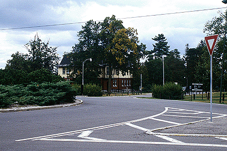
Prince of Wales Drive at Traffic Circle [Source: PFS]
Traffic control at intersections impose additional constraints on transportation system capacity. The City of Ottawa has adopted criteria that directly relate the volume to capacity ratio of a signalized intersection (driven by the most critical movement) to a level-of-service rating. The existing levels-of-service at key study area intersections for each peak hour have been analysed. The results indicate that three study area intersections located on Baseline Road are currently operating at or slightly above capacity during both peak hours. Similarly, the intersection pair at Carling/Preston and Prince of Wales/Preston are currently operating at or slightly above capacity during the PM peak hour. All other study area intersections were found to operate at acceptable levels-of-service during both peak periods.

Intersection of Baseline and Merivale, 2003 [Source: Contentworks]
Other Known Development Proposals
Within the immediate vicinity of the study area, several other potential development proposals have been identified. These include the following:
- the potential expansion of the Dow's Lake facility to include an entertainment/hotel complex (to be located on parcel of land situated to the southwest of the Carling/Preston intersection)
- the potential expansion of the Confederation Heights employment node (located to the southeast of the CEF site)
- continuing build-out of the Central Park residential community (located to the west of Merivale Road)
- the redevelopment of the Royal Ottawa Hospital
- the potential intensification of the NRCan Booth Street campus and adjacent lands as an employment node.
Further removed from the site, the redevelopment of LeBreton Flats over the next 5 to 20 years will impact traffic demand on the surrounding transportation network specifically Preston Street if it is extended north from Scott Street through to the proposed LeBreton Boulevard).
Existing Transportation Policy
The City of Ottawa is currently in the process of preparing a Transportation Master Plan (TMP) that harmonizes the transportation operations and policies of the previous eleven area municipalities and the regional municipality. A draft of the TMP was prepared in March 2003 and a revised draft went to the Transportation and Transit Committee for approval on July 16, 2003. It established infrastructure and program needs and supporting policies for Ottawa-Carleton's transportation system to the year 2021. One notable objective of this TMP is to maximize environmental sustainability of the transportation system. Sustainability can be increased by limiting the growth of travel demands, and by promoting and serving environmentally-friendly travel alternatives (namely walking, cycling and public transit) as a preferred alternative to automobile use. Other notable objectives of the TMP include: to support the proposed distribution of population and employment; to maximize accessibility for residents; and to maximize economic sustainability of the transportation system. As the future City of Ottawa TMP will most certainly echo these objectives, any development proposal for the CEF should be structured in a way that is responsive to them.