
Analysis
III.1 Introduction
This section provides an analysis of the information in the previous sections, and establishes a context for looking at management plan options for the site. As indicated at the outset, the Central Experimental Farm has been designated a cultural landscape of national historic significance, and this colours any discussion of its future. Despite the designation, it is not a static site; it is a dynamic one, and this dynamic quality is in fact part of its history and its value. The requirement in terms of management planning is to sustain the underlying, cohesive qualities of the site at a broad level, while allowing significant evolution of individual components and programs at a local level.
Cultural Landscape and Cultural Identity
The concept of 'cultural landscape' is a relatively recent one, particularly as applied to the management of real property. It is an area where Canada has taken a lead role internationally in defining the term and investigating its implications.
A cultural landscape is both a physical reality and an imagined reality. It occurs at the intersection of physical and mental geographies. This is why it is not simply a landscape - which is a physical reality - but a 'cultural' landscape, taking its significance from the cultural assumptions which allow a shared understanding of the place to develop. Different cultural groups may understand the same landscape differently, and in this case different cultural landscapes with different boundaries may coexist.
UNESCO, at the international level, identifies three categories of cultural landscape - designed, evolved and associative. These three categories have quite different implications for management.
In a designed cultural landscape, there is a direct one-to-one correspondence between the imagined landscape and the physical landscape. When the design is implemented, the idea is turned into physical reality. The management of such landscapes is reasonably straightforward. The design intentions must be understood and respected, and the landscape treated in ways that demonstrate and protect these intentions. Change is kept to a minimum. The Halifax Public Gardens are a Canadian example of a designed cultural landscape, relatively unchanged from their late 19th century patterns.
In an evolved cultural landscape, an initial design is gradually overlaid with successive layers of alteration and adaptation. There is still an overall connection with a central idea and its physical manifestation, but both the idea and the physical reality can evolve with changing technologies and new patterns of cultural activity. Parts of the St. Lawrence River valley in Quebec are good examples of an evolved cultural landscape, where the initial rural patterns were established in the 17th and 18th centuries and continue to be evident, although much altered, today. The management of these landscapes is more complex, but is still driven by the central organizing idea and the need to protect the evidence of this idea in the physical landscape.
In an associative cultural landscape, the relationship between the imagined landscape and the physical landscape is often not evident. In these landscapes, one has to understand the imagined realities of a particular culture in order to understand how its values are embedded in the landscape. These values may not transform the physical reality of a site, the way a designed landscape does. They simply create an important association between a given landscape and a given mental construct. A wilderness site can be an example of an associative cultural landscape. To a local aboriginal community, it may be a sacred site because of cultural patterns that use this landscape for rites of passage and for communal celebrations that are specific to the place. To the tourist community, it may be a recreational landscape with very different patterns of use and of understanding. To the mining community, the landscape may have associated values that are mapped in a yet again different way. Associative cultural landscapes are the most difficult to manage, because the management must address physical changes in relation to one or more mental geographies that give the place its value.
The Central Experimental Farm as a Cultural Landscape
In examining the evolution of the Central Experimental Farm, and considering its present status, it is possible to divide its history into three major phases. In an oversimplified way, it can be said to move from being a designed landscape, to an evolved landscape, to an associative landscape.
Phase I: 1886-1936 - The Designated Landscape
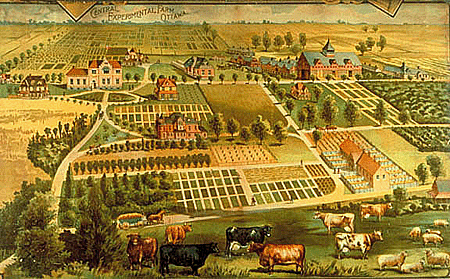
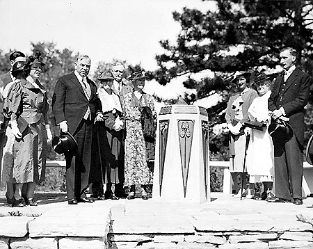
In the first phase, which established the underlying character of today's cultural landscape, a bold design for the site was conceived and implemented. This design is best understood in the context of Victorian and Edwardian attitudes to science. There is a picturesque quality to some of its features, as noted by the Historic Sites and Monuments Board. But it is essentially a scientific landscape, and was designed as such. A contemporary poster from 1890 provides a mental image of the site. Although not a direct physical representation, it is useful in understanding the design intentions. As the farm evolved over these first few decades, it adopted very much the ordered scientific qualities indicated in this image.
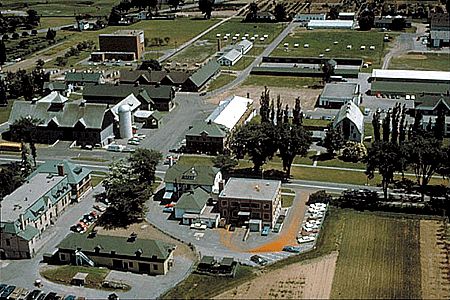
The 1888 site plan was the first known representation of the farm, created a year after it opened. The 1897 plan is a more detailed record of the site. There are some key aspects to these plans which still form the basis for understanding and managing the site.
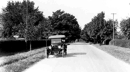
The site was approached from the northeast. This reflected the visual and functional orientation of the site towards Parliament Hill. The entry zone itself was a carefully designed picturesque landscape which clearly established the federal identity of the site. It provided an introduction to the site that could be easily understood in the context of federal urban design at the time. This was twenty years after the shaping of the Rideau Hall landscape for the Governors General, but the approach was the same - a curvilinear drive through a carefully planted woodland. The site was further enhanced by the water feature, Dow's Lake. It was William Saunders, the designer and first Director of the farm, who had the stumps pulled from the Dow's Lake swamp to create a water forecourt for the picturesque landscape of this zone.
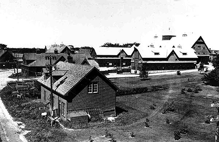
The core of the site was set behind this picturesque entry zone. The ornate Director's House provided the important point of arrival, and beyond it were arrayed the residences, barns, greenhouses, and laboratory buildings of the fledgling institution. In this core zone, the landscape was more dense and ordered, with more intimate plantings.
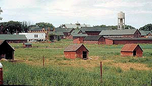
The working area or support zone of the site consisted of the farm fields stretching west and south from the core. This was the working landscape of the site, the heart of scientific activity and the justification for the other zones. The design of these fields was functional and rectilinear. There was very little of the picturesque landscape left. The only significant exception was the wooded drives which continued through the site from the central node, one heading west and one south. The special treatment of these roads ceased when they left the federal precinct and moved into the more functional local identity of the adjacent farmland and suburban settlements.
These images illustrate the issue of federal identity. As has been pointed out elsewhere, the 19th century saw the emergence of a distinctive federal vocabulary in both architecture and landscape. This picturesque vocabulary was used to extend the federal presence through the Capital by means of a series of parkways and tree-lined streets. In the case of the Central Experimental Farm, the initial construction of the Queen Elizabeth Driveway to Lansdowne Park created a federal avenue halfway to the farm. As soon as it was feasible, the driveway was extended and ended at the Farm itself. A causeway was built across Dow's Lake to circumvent Booth's lumber yards and to provide an uninterrupted pathway from Parliament Hill to the Director's Residence.
[Source: Report and Correspondence of the
Ottawa Improvement Commission (Ottawa, 1912)]
Once within the site, the picturesque landscape idiom was fully developed in the northeast quadrant of the site, on both sides of Prince of Wales Drive. This was the part of the site with the most dramatic topography, and it lent itself to appropriate winding paths and framing of views. The detailing of both the hard and soft landscape treatments was consistent and of high quality. The larger tree specimens were ranged across the landscape, from Dow's Lake right into the core area. The more intimate shrubs and flowers were concentrated in the more intimately scaled landscape towards the core. These sophisticated plantings demonstrated the interest of Farm personnel in the intersection between beauty and utility. A scientific approach to the Arboretum, the Ornamental Gardens, and the hedge collections was needed to allow the farming community and the agriculture community to understand the use of these plant materials for both the beauty and the health of their own establishments.
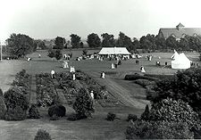
From the picturesque entry zone one moved into the core area of the Farm. The Director's House was intended to be approached from the northeast, and had its own small semicircular driveway in appropriate picturesque fashion. The image of a turn-of-the-century garden party speaks to two aspects of the site - first, its park-like quality at the intersection of the entrance zone with the core area, consistent with federal principles at the time; and secondly, the public face of the farm, and of science more generally. It was in the core area that the scientists and the public interacted.

For the general public in the Victorian and Edwardian ages, science was a tangible and remarkable activity. Scientific advances were providing broad advances in areas such as water purification and distribution, lighting, and transportation. Agricultural science was no exception. The Minister of Agriculture at the time of the founding of the Farm, Sir John Carling, was one of those who understood the immediate applicability of scientific research to rural and agricultural development in Canada. The fact that the Director or the Minister would host a garden party at this site was part of a wider belief in the public importance of such institutions.
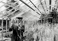
Historic images of the Central Experimental Farm indicate the tangible quality of scientific research at the time. This is a science that depended more on empirical findings than on theoretical formulation. In fact, as an editorial in the Farmer's Advocate in the 1880s put it, "if agricultural writers will guarantee to give us nothing but the pure science, explain to us in each instance where the theory ends and the science begins...then we will applaud". The interaction with the public occurred in the core areas of the farm. In the carefully developed demonstration plots, greenhouses, and laboratories, this part of the farm received many members of the public directly and dealt with hundreds of thousands more through indirect communication via mailings and written responses to inquiries.

Isabella Preston, Horticulturist
[Source: Ottawa's Farm]
Garden Party at the CEF, c 1900
[Source: NA, PA-13128]
L. Newman, Dominion Cerealist 1930
[Source: NA, PA-143701]
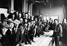
Grain Cleaning Demonstration 1910
[Source: NA, PA-143700]
Early in this period streetcar service was extended from the centre of Ottawa out to the Farm. This reflected other streetcar extensions out to Britannia Bay, Rockcliffe Park, and other picturesque landscapes within reach of the urban centre. In the case of the farm, the terminus was also the location of an auditorium, again reflecting the public face of the farm.
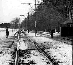
[Source: COA, CA-18224]
On the back side of the core were the more functional underpinnings of the experimental farm operation, and beyond were the open fields, extending further and further to the west and south. These fields provided the raw material for the scientific information shared with the public and made accessible to local, national, and even international visitors. There is a rural quality to the open fields in this support zone, but the actual crop pattern with its demonstration plots and controlled experimentation still reflected the underlying identity of the place as a scientific landscape. This was a research institution, not a model farm.
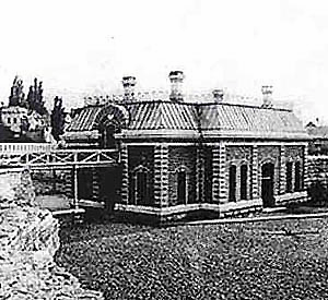
One can compare the Central Experimental Farm with another, much smaller, scientific landscape in Ottawa from the late 19th century. The Fleet Street pumping station provided the first major public water system for city residents. What is interesting is the design of the site - a picturesque entry zone, complete with winding paths, semicircular drive, and dramatic plantings; a core area defined by the stone building itself, with formal entrance halls and Director's offices, where the public could visit and have the science explained; and then the back working yards of the pumping station, with the turbines and pumps and weirs that did the actual work. This layout is a microcosm of the Central Experimental Farm site.
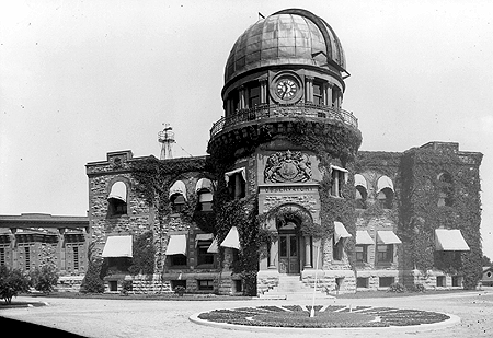
Other agencies moved onto the Farm property during this period. In general, they respected the overall intentions of the design. The Dominion Observatory complex was part of an investigation of astronomy, meteorology and seismology. It involved a picturesque use of materials in keeping with the federal vocabulary of the time, an appropriate layout of roads, and a reinforcement of the core area as the site of public interaction with the science of the place. Although located near Carling Avenue, this building did not face Carling but faced towards the centre of the Farm and turned its back on the civic neighbourhood to the north. It was among the best-known buildings in the city. Thousands of visitors observed the skies through its telescope and admired the garden sundial at its entrance.
By the end of this first phase, there was in place a clear, designed cultural landscape - a product of a particular vision, implemented with remarkable consistency and extremely successful in conveying that vision to a broad public. The Central Experimental Farm was a much-admired institution, in a well-appreciated setting.
Phase II: 1936-1986 - The Evolved Landscape
The second phase began in 1936. That was the year that the Director's Residence was torn down and replaced with the Saunders Building. There was a symbolic significance in this change, because the new building was oriented inwards, towards the core, rather than outwards towards the approach drive from the northeast. This was the period in which science was moving further away from the empirical to the theoretical, taking with it a less public face.
A year later the entire experimental farm network throughout the country was reorganized to provide a system-wide rationalization. The Central Experimental Farm became less of a stand-alone institution and more of one element in a far-flung system. The system itself was becoming more abstract to the public, who could not see, in one place, all the activities that made agricultural research so relevant to their lives.
As a result of these changes, the Central Experimental Farm became an evolved cultural landscape - a landscape where there was still one central idea, about research, but changing ways in which that idea was expressed in the physical architecture and landscape of the place.
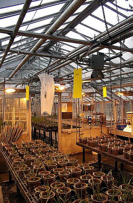
As part of the more theoretical underpinnings of science, it moved indoors, to controlled environments. The buildings that were constructed were more functional than picturesque in their architecture. There was less of a conscious sense of public invitation. The electric streetcars disappeared, and so did the public auditorium. The federal driveways continued to pass through the farm, but there was not a strong connection between them and the landscape - they were simply free-standing corridors through the site. Overall, the picturesque landscape qualities of the site were sustained but were not reinforced. The shelter belts along the north side of the site, adjacent to Carling Avenue, and some along the west side of the site, were cut down. The site lost some of its sense of separation from the surrounding civic landscape.
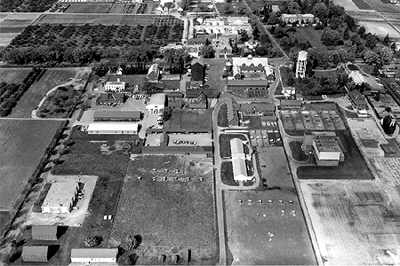
Images of the Farm from this period show a science that has moved indoors. There was an increasing sense that the heart of the research community was in the laboratories and greenhouses, and that the fields played a supporting role more than a primary role in the practice of scientific inquiry. There was still, however, an importance attached to the overall site as a scientific landscape. The addition and deletion of buildings, the rerouting of roads, and the modifications to the landscape features, continue to be carried out in the context of overall research objectives and the continuing importance of agricultural research within Canada.
Phase III: 1986 to Present - The Associative Landscape
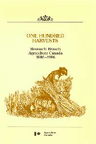
The third phase in the Farm's history began in 1986, with the celebration of the Farm's centennial. The publication of One Hundred Harvests by Dr. T. Anstey was one of the products of that celebration. The centennial heightened awareness of the Farm within the community, and create much more discussion of its present and future roles. The awareness was further sharpened by discussions about whether or not to continue research activity at the Farm, and even whether the land should stay in public ownership. What is important in the present context is that the heightened awareness began to take on many forms. What was emerging was an associative cultural landscape with overlapping layers of meaning.
One association with the Farm has been an ongoing understanding of the place as a key centre for agricultural research. The Eastern Cereals and Oilseeds Research Centre has an active research program, which uses most of the field area (the working backdrop for the Farm), and many of the buildings and plots in the core area. The Interim Management Plan of 2000 commits AAFC to ongoing support of this research program at the Farm for the foreseeable future.
This view of the site produces a particular perspective on the management of lands and buildings, and on the appropriate patterns for evolution. It tends to organize the site outwards from the principal laboratory buildings. It draws protective lines around the research buildings and lands, to avoid contamination of these sites by informal interventions by others. It views the site in functional terms, but also in terms of historical continuity. It is an aspect of the site that still draws many visitors, but mostly other scientists and researchers. ECORC personnel are well positioned to articulate this view.
Another, emerging, association with the place has been to understand the Farm primarily in historical context. This has meant a strong concern for the original designed landscape, and for the surviving evidence of this 19th century concept. It implies an interest in understanding the heritage values of the site and then communicating these values to the public. It implies reviewing any proposed changes in relation to their impact on heritage value.
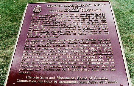
The designation by the Historic Sites and Monuments Board, and the development of a Commemorative Integrity Statement by the various partners involved, under Parks Canada leadership, are evidence of this view of the site. Parks Canada personnel are well positioned to articulate this view.


ECORC Activities
Another recent association with the site has been to understand the Farm as a place to interpret agriculture and agricultural history to the public. In some ways, this can be seen as reflecting a more public interest in science, recalling the first phase of the Farm's existence in the 1886-1936 period. Public visitation to the Farm has increased dramatically since the centennial, and many of these visitors come to be educated. The Agriculture Museum, operated under the aegis ofion invo the National Museum of Science and Technology, is the core institutlved in this activity.
This view of the site is partly related to the sense of this place as a historic site; it is also partly related to the sense of this place as an active research centre. But it also goes beyond both to an interest in the history and practice of agriculture across Canada. In terms of site management, this view of the site is very interested in how the public moves onto the site and how possible visitor flows can best be supported and managed. Agriculture Museum personnel are well positioned to articulate this view.
A related association with the site has been to understand the Farm as a place where private initiatives may gradually replace public initiatives in carrying out research and development activity on site. The Fletcher Wildlife Garden is an example of this trend, as is the involvement of Friends of the Farm in the ongoing development of the Arboretum and aspects of the Ornamental Gardens. The recent proposals by the Ottawa Botanical Garden Society also fall into this pattern.
Fletcher Wildlife Garden, 2002
These initiatives tend to have both their own research concerns and an interest in interpreting and presenting this research to a wider public. In some cases, this interpretation becomes the means of raising the revenue necessary to sustain the activity. The implications for the development of the site are thus related both to the evolving nature of the research interests, and the need to attract and manage public visitors. Fletcher Wildlife Garden and Friends of the Farm personnel are well positioned to articulate this view.
Another important and developing association with the site has been to understand the Farm as a public park. This is not unrelated to the original design intentions, particularly in the entrance zone, but with more emphasis on the aesthetic and less on the scientific. This view of the Farm focuses on the Arboretum, the Ornamental Gardens, and other open spaces as part of a network of public parks and pathways throughout the National Capital. It is an association shared by a variety of users, including walkers, joggers, cyclists, dog owners, picnickers, wedding party participants and photographers, and even Sunday drivers, all of whom appreciate the picturesque landscape, the opportunities for passive and active recreation, and the contrast between this site and its relatively developed urban neighbourhood. This view of the site as parkland is also consistent with the management plan objectives of the Rideau Canal, which encourages public use of lock stations and adjacent lands for passive recreation and enjoyment, and of the NCC, which controls part of the shoreline and emphasizes pubic use on all of its properties.

This view of the site is expressed in a number of the planning documents for the area, including those produced by the NCC and the City of Ottawa. They identify the Farm, and particularly its eastern components, as part of larger networks described variously as Capital Urban Green Space, Capital Parkways, Capital Pathways, and the Greenway System. NCC personnel are well positioned to articulate this view.
Another association with the site is to view the Farm as the seat of AAFC's headquarters function. This is a relatively recent addition to the Farm's landscape, dating from the 1960s, and something of an anomaly within the plan. However, it was appropriately sited within the entrance zone, where it could be a relatively independent pavilion in the park and where it could share in an area of strong federal identity. Originally sited closer to Carling Avenue, it was moved towards Prince of Wales and its exterior redesigned in masonry rather than glass and steel to give it more of a federal rather than a civic presence. The result is a building that sits reasonably well, given its size, within the picturesque landscape of this area. The fact that it sits separate from the core buildings to the south and west is appropriate, because the headquarters function does not involve itself directly with these activities.
This association will change with the move of the headquarters function off the present site and onto the adjacent Skyline campus of Nortel.
Overall, this recent phase has seen an overlay of many different associations, many leaving people with different assumptions about the character and value of the site.