
V.4 - Design Guidelines
Entry Zone
Landscape Character Defining Elements
The character defining elements of the Entry Zone are:
- Expansive lawn areas with mature specimen trees and curving paths
- Long, framed vistas and varied, dramatic topography
- Overlooks to Dow's Lake and the Rideau Canal
- Roadways designed in the parkway tradition.
Design Directions
The emphasis for future design and management efforts should be on rehabilitation of the historic landscape and its open, public, and Picturesque attributes. No new buildings or significant hard landscape features should interrupt the predominance of the soft landscape and the pastoral quality of this zone. The only suitable site for buildings is in the vicinity of the existing group of buildings near the traffic circle that support the Arboretum; a building in this area is only justified in relation to the management and expansion of research related to the tree collection. A new structure in this location should be designed and sited to integrate with the existing buildings to create a meaningful 'family' grouping.
The environmental resources of this zone, including wetland, woodland, and grassland sub-zones, as identified in the City of Ottawa Natural and Open Space Study (NOSS), should be protected and enhanced within the limitations of the cultural landscape directions for this zone.
The sense of open public access into and throughout the Entry Zone is integral to its landscape character and should be improved with upgraded pathways, signage, and seating. Introduction of fences should be avoided.
The progressional experience of moving up the hill from Dow's Lake to the entrance at the traffic circle should be rehabilitated and enhanced in keeping with the historic landscape record. Specifically, improvements to the streetscape, the treatment of the traffic circle, and the gateways to the Core Zone and the Arboretum should be refurbished (refer to detailed design guidelines). The parkway design approach to Prince of Wales south of the traffic circle should be reinstated according to the historical record and no future road widenings permitted within the Central Experimental Farm.

Core Zone
Landscape Character Defining Elements
The character defining elements of the Core Zone are:
- An ordered, structured landscape
- A varied mix of building sizes and uses to accommodate agricultural research and related activities in close juxtaposition within a campus setting
- Remnants of historic vegetation research collections
- Shared use by the public and the research community
- An informal, non-rectilinear grid of local roads.

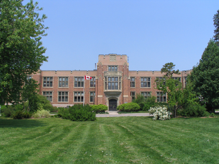
View Towards Nutrition Building [Source: PFS]
Design Directions
Through the management planning process, the Research direction was selected. This choice has important implications for the Core Zone in particular. The historic role of this zone as the meeting place for the public and scientists interested in agricultural research and excellence should be the inspiration for the redevelopment of all sites within this zone to reinforce a sense of a research campus. Initiatives in support of this objective should include:
- Rehabilitation of the NCC Driveway as the 'Main Street' of the Central Experimental Farm with reference to historical photographs
- Redevelopment of the Carling Building site to become a visitor's centre and to house the national seed and insect collections
- Expansion of the research facilities in the vicinity of the Neatby building, including a major new greenhouse research area
- Introduction of new public uses for conferences and meetings
- Reinvigoration of the public open spaces on both sides of the Saunders Building to achieve a program of informal public / research engagement
- Retention of a mix of agricultural and research activities around the perimeter of the Canada Agriculture Museum while permitting museum use of some additional buildings in this vicinity
- Rationalization of the onsite circulation and parking and improvements to the landscape setting of buildings (refer to design guidelines).
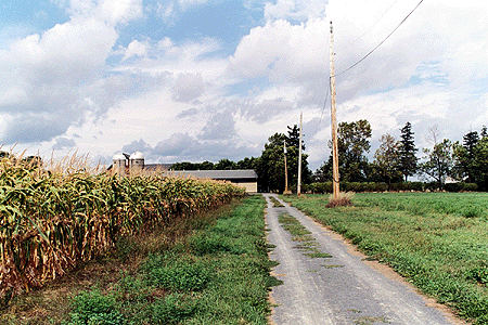
Support Zone
Landscape Character Designing Elements
The character defining elements of the Support Zone are:
- An ordered agricultural landscape with a rectilinear grid of local roads and drainage ditches
- Scattered agricultural support buildings
- A variety of field crops within a unifying landscape setting.
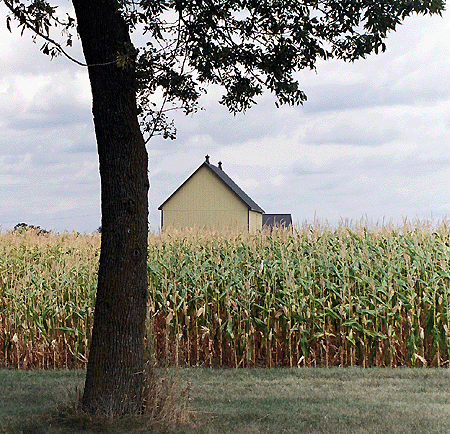
Support Zone [Source: PFS]
Design Directions
The research fields are the predominant feature of the support zone and will retain their role into the future although the crops and experiments conducted on them will change. The primary anticipated impact on the Support Zone is increased traffic on peripheral roads and the intent to bring the new headquarters complex into a meaningful relationship with the Central Experimental Farm. The design guidelines for streetscapes discuss the desired improvements to Merivale and Fisher to address landscape character and creation of gateways.
Streetscapes
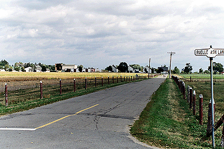
The streets that form the edges of the Central Experimental Farm should express a special character in these adjacent sections that relates to the cultural landscape of the Farm. These streetscapes include portions of Merivale Road, Fisher Avenue, and Prince of Wales Drive (north-south) and Baseline Road and Carling Avenue (east-west). The NCC Driveway is the dominant internal street in relation to a network of narrow access roadways.
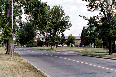
NCC Driveway [Source: PFS]
Merivale Road
Analysis: Merivale is a four-lane divided arterial road. The proposed ROW protection noted in the current City of Ottawa Official Plan for Merivale Road adjacent to the site is 37.5m (an additional 4.4m may be required on the east side to accommodate a rural cross-section). Although there are generally sidewalks on both sides of Merivale, only the west side has a sidewalk in the section through to the Farm.
Guidelines: The asymmetrical treatment of Merivale with a typical urban expression on the west side and a rural character on the east side should be reinforced. No further road widening should be permitted. The east side should be enhanced with a landscape appropriate to the Farm featuring a gravel shoulder , a double row of tall fastigiated trees, suggesting a windrow, within a minimum 4 meter wide grassed boulevard and no curb. A grassed swale should provide surface drainage.
Merivale Road [Source: Contentworks]
With the acquisition of the Skyline Campus, Merivale Road gains an increased importance as a gateway to Agriculture Canada Headquarters and as an interface between urban and rural components of the Central Experimental Farm. Street trees of the same fastigiated species within the west side streetscape should be used an integrating element on both sides of the roadway adjacent to the Skyline facility. Opportunities for areas of soft landscaping should be created as part of the Merivale gateway at Baseline Road, including consideration of changes to the layout of parking lots and of a median within the Merivale roadway for the depth of the Skyline site.
Fisher Avenue
Analysis: Fisher Avenue is currently a two-lane undivided rural arterial with a sidewalk on the west side. The proposed right-of-way protection is 37.5 meters between Baseline and Carling, sufficient to accommodate a four lane roadway. A widening to four lanes is currently planned between Dynes Road and the NCC Driveway for transit priority purposes. The east side of Fisher Avenue in the vicinity of the NCC Driveway is edged by the remaining 1880's shelterbelt, an area that has Urban Natural Features designation in the City's Official Plan. Any widening of Fisher Avenue between Baseline and Carling, including improvements in support of public transit, will have visual and functional impacts on the Central Experimental Farm.
The current draft of the Transportation Master Plan for Ottawa provides that consideration will be given to waiving or reducing requirements for road widening that would result in immitigable adverse effects on built or natural heritage features deemed of significance to the City. A case should be made that widening of Fisher between Baseline and Cow Lane would have a negative impact on the landscape character of the Farm and the widening between Cow Lane and Carling would seriously compromise the natural and heritage values of the shelterbelt.
Guidelines: Fisher Avenue should have a special and appropriate landscape character between Baseline and Carling. In the southern section, where Fisher is bordered by research fields on both sides, the preferred streetscape should include: two travel lanes of a maximum width of 3.5 meters, a 2 meter wide gravel shoulder, a single or double row of tall fastigiated trees, evoking a windrow, within a 2 to 4 meter wide grassed boulevard with a slightly swaled edge and no curb. In its northern section where Fisher abuts the remnant shelterbelt, the roadway should retain its current dimensions and the shelterbelt should be managed to preserve and enhance its historic appearance and its values as wildlife habitat.
Prince of Wales Drive
Analysis: Prince of Wales is an integral part of the historic landscape of the Central Experimental Farm. It is a two lane undivided arterial within a proposed 26m right-of-way (an additional 4.4m may be required on the west side to accommodate a rural cross section). It is both a designated bicycle and transit route. Prince of Wales is identified in the City of Ottawa Official Plan as a Scenic-Entry Route with a set of criteria related to future development applications along it.
Prince of Wales Drive north of the traffic circle is designated Capital Parkway, connecting with Queen Elizabeth Drive on the east and Island Park Drive on the northwest in the NCC's Plan for Canada's Capital (PFCC). The PFCC designates Prince of Wales Drive south of the traffic circle as Scenic Entry, matching the designation in the Official Plan. Due both to the connectivity of Prince of Wales Drive with the NCR Federal Capital Parkway system, and the potential of this roadway to sever historic and contemporary landscape and land use patterns within the National Historic Site, the Central Experimental Farm National Historic Site Management Plan establishes design guidelines for Prince of Wales Drive as an urban parkway within the Central Experimental Farm boundaries.
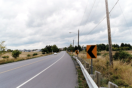
Prince of Wales Drive [Source: PFS]
Guidelines: Prince of Wales Drive should be maintained as a two lane road with two driving lanes of 3.5 meters maximum width and a 4 meter wide central median. Each side of the roadway should be designed to include: a 2 meter wide boulevard, a 2 to 3 meter wide pedestrian and bicycle pathway, and an edge treatment with a grassed swale. Street trees should be included in a staggered double row in the median and in single rows on both sides of the pathways. All soft landscape areas should be treated in a cohesive way with mowed grass or grass allowed to naturalize as a meadow condition to emphasize the desired rural character intended within the Central Experimental Farm.
The existing traffic circle at the intersection with the Experimental Farm Driveway should be retained and redeveloped to achieve better sightlines and a more appropriate and simple landscape character. A new traffic circle with a similar but relatively smaller treatment, to reflect its secondary role in a hierarchy, should be introduced at the intersection with the road that leads to the Hartwell Locks to the east. Both traffic circles achieve traffic calming along Prince of Wales in a form that is consistent with its historic parkway typology.
A hedge approximately 1 meter in height should be planted along both sides of Prince of Wales from the Dow's Lake entrance up the hill to the traffic circle in the same general location as the remnants of existing hedge in this area. This hedge height would retain views into the farm and the Arboretum. This particular stretch of road should be perceived as the main public entry to the Farm and, as such, should receive a streetscape treatment at the highest level in the design hierarchy for the site.
Baseline Road
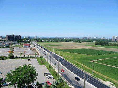
Analysis: Baseline Road is an urban arterial with 4 lanes in a proposed 44.5 meter right-of-way. The current plans for Baseline call for a widening to 6 lanes between Woodroffe Avenue and Prince of Wales Drive for transit priority improvements. Only the south side has a sidewalk. Any future widening of Baseline Road will have an impact on the rural character of the fields on the south perimeter of the Farm; however, the current character already involves a strong contrast between the agricultural fields to the north and the residential land uses on the south.
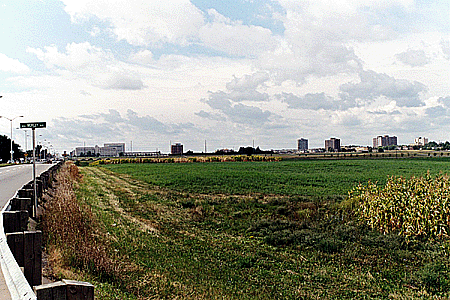
View West along Baseline Road [Source: PFS]
Guidelines: The streetscape treatment of the north side of Baseline should continue to express a rural, agricultural character with a soft shoulder and no sidewalks. (Refer to the section on Fences for further related guidelines.) The design of transit stops and other transit related facilities within the north half of the roadway should be simple and as minimal in their size and visual impacts as possible. Structures should be avoided.
Carling Avenue
Analysis: Carling is a six lane divided urban arterial scaled to the important civic institutions fronting on it and in strong contrast to the research fields west of the hospital helipad. Carling serves as the vehicular access to and address for the major buildings on the Central Experimental Farm lands. However, buildings have traditionally had their 'front door' presence on internal roadways and open spaces, including the Observatory and the Carling Building.
Guidelines: The siting and design of new and renovated buildings in the vicinity of Carling Avenue should emphasize a 'front door' on internal roads and courtyards and service and vehicular access from Carling. The vehicular access at Maple Drive should be relocated to the east side of the Neatby building, allowing the design of an improved setting and sense of ceremonial arrival to the forecourt of the Observatory, with reference to historic photographs of this area.
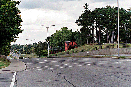
View East along Carling Avenue [Source: PFS]
Consideration should be given to extending the treed buffer along the northern portion of Fisher along the south side of Carling Avenue as far east as the boundary of the expanded research campus. Historically, this treed condition existed along Carling in approximately this location. The selection of trees used in this area could be coordinated with urban forestry or farm windbreak research.
The National Capital Commission Driveway
Analysis: The NCC Driveway, also referred to as the Experimental Farm Driveway, is the extension of Island Park Drive through the Central Experimental Farm terminating at the traffic circle on Prince of Wales Drive. It is currently under the jurisdiction of the NCC. It is an undivided parkway with two lanes for vehicles, a sidewalk on the north side, and a bicycle lane on the south side.
NCC Driveway [Source: PFS]
The streetscape along the NCC Driveway is generally appropriate to its parkway status although it lacks consistency of treatment, especially in the vicinity of the Dairy Barn, and has a diminished character from its historic configuration when it was the central spine at the heart of the Central Experimental Farm and the Auditorium and the Ottawa Electric Railway station were in place.
Guidelines: The NCC standards for parkway design and management should continue to apply to the Driveway and should guide the replacement over time of areas where exceptions to an consistent overall treatment have occurred.
Internal Roadways
Analysis: The internal road streetscapes are generally appropriate in scale and treatment to their landscape setting.
Guidelines: No internal road widenings should be permitted. Many internal roads have curbs but their narrow width and the simplicity of the curbing supports a rural character. Roads within the research fields that are not already curbed should not be curbed and should have soft shoulders and adjacent ditches / swales.
Paving
Roadways
Analysis: The primary roadway material is asphalt with some use of gravel within the field zone. In almost all cases, the asphalt roads are appropriately understood as more heavily used, except by farm equipment, than the gravel roadways. These paving treatments complement the historic design intentions for the Farm.

Guidelines: Asphalt should be used as the surfacing for all roads within the entry and core zones and for major roads within the field zone. Stabilized gravel should be the surfacing of all minor roads providing access within the research fields. Unit pavers or other special paving treatments should not be used within roadways to ensure that the current simple, consistent treatment is maintained.
Curbs
Analysis: Curbing occurs generally on the internal roads that receive heavier use and are typically concrete in either a low barrier section or a more modern rolled profile. Many minor roadways are not curbed. Curbing is largely an intervention that is foreign to a historic Picturesque landscape. Nevertheless, the curbing on the Central Experimental Farm is largely subtle and unobtrusive.

Typical Curb Treatment [Source: PFS]
Guidelines: New curbing should be minimized within the Central Experimental Farm and used only on roadways in the core area of the Farm that will receive relatively heavy vehicular traffic. Where curbing is used it should be the traditional, low barrier form in plain concrete rather than rolled to minimize its surface area. When roadway work is undertaken, consideration should be given to the feasibility of removing curbing in lower traffic areas and to removal of related catch basins and associated sub-surface piped drainage in favour of directing surface water into ditches or swales.
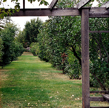
Paths
Analysis: Most pathways are gravel surfaced with a few major routes paved in asphalt. Some sidewalks and a few pathways are finished in concrete with a standard broom finish typical of urban streets.
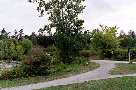
Pathway along Arboretum [Source: PFS]
Guidelines: Continued use of gravel surfaces for most pedestrian pathways is recommended. Crushed local aggregates with stabilizer to provide good binding and reasonably smooth surfaces, particularly in consideration of universal access, should be used.
Research Field [Source: PFS]
Existing asphalt pathways with informal character and edge treatment should be retained or, if rebuilt, replaced with gravel. Existing concrete sidewalks may remain but should be replaced with asphalt or gravel to suit their level of use as rebuilding is warranted. In no instance should unit pavers or other paving treatments be utilized for pathways.
Plazas
Analysis: Current building forecourts and outdoor courtyards have a variety of surface treatments that have been designed in relation to their adjacent buildings rather than in response to the overall landscape character of the Farm.
Guidelines: While recognizing that plazas and courtyards should relate to the design and materials of the building with which they are associated, a consistent overall palette of paving materials is desirable to bring cohesiveness to the site. Preferred paving materials for plazas and courtyards include well detailed concrete and stone, preferably in large modules.
Parking Lots
Analysis: Existing surface parking lots are located in proximity to all major buildings with the exception of the museum complex which is served by a large public parking lot to its south with access from Prince of Wales Drive. There is demand for more parking on the site, particularly west of Maple Drive and north of the NCC Driveway.
Typical On-site Parking Lot [Source: PFS]
Guidelines: Generally parking areas on the site should be dispersed into small discreet pockets wherever possible and sited to the side or rear of the front façade of buildings. Where large parking lots occur, their visual impact should be mitigated with extensive plantings of trees. One appropriate design expression is a regular planting on a grid that references the orchards that once grew as demonstrations within the core area of the Farm that would give visitors a sense of parking within an orchard. Care should be given to minimizing the extent of impermeable paving, including consideration of permeable pavers and grass-pave systems, and to the removal of any parking lots that are not needed due to building demolition or changes in use. Surface drainage from parking lots should be managed with reference to sustainable best practices.
Drainage
Analysis: Much of the hard surfaced areas within the Central Experimental Farm are flush with the surrounding soft landscape and drain into the ground directly.
Guidelines: Wherever possible, runoff from hard surfaces should be directed into areas of soft landscaping to achieve sustainability objectives and avoid curbs and drains.
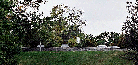
Walls and Fences
Walls
Analysis: Walls are not a common element on the Central Experimental Farm. Those that exist have a variety of materials and design expressions (refer to photographs). Some walls are appropriate to the Picturesque landscape and others are not.
Arboretum [Source: PFS]
Guidelines: Walls should be used only within the entry and core portions of the Central Experimental Farm and should be made of limestone, keeping with the existing walls within the arboretum landscape. Low walls may be suited to seating and signage applications as described in the sections on Site Furnishings and Signage.
Fences
Analysis: Fences are used in a number of places around and within the Central Experimental Farm site. Their application is not, however, consistent. A variety of forms are used, including one based on historic fences that utilizes page wire and pointed wooden posts.
Typical Internal Fencing [Source: PFS]
Guidelines: A fence detail should be refined that references historical agricultural forms and uses page wire but with a more accurately detailed post. This type of fencing is cost-effective and appropriate to the cultural landscape, particularly within the support zone and at the interface between the support zone and the core zone. Fences should be used consistently around the perimeter of all research fields where they are adjacent to public roads and internally where needed for research purposes. This will enhance and celebrate the boundaries of the Farm along its public edges and assist with control of dogs. Clearly identifiable pedestrian entry points should be made legible for the public as breaks in the fence, reducing the need for extensive signage.

View Through Page Wire Fencing [Source: PFS]
Fences should not be introduced in the entry zone and the interface between the entry zone and the core zone, where they were not present historically. The only exception would be immediately adjacent to some of the buildings, where there were some board fences designed to a higher level of finish and detail. These historic precedents could be used for small areas of fencing adjacent to buildings in the core. The Arboretum on both sides of Prince of Wales, the Ornamental Gardens, the Hedge Collection, and the other plant collection areas should remain unfenced to retain the open landscape identity when viewed from Prince of Wales and along the Rideau Canal.
Site Furnishings
Benches
Analysis: The Arboretum has a number of green, slatted benches that are an appropriate style for their application.
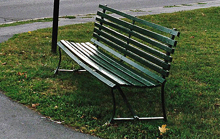
CEF Bench, 2003 [Source: PFS]
Guidelines: The bench used as a standard in the Arboretum should be used throughout the entry and core areas where benches are needed. Benches should not be used in the research field zone. Where a substantial amount of seating is required, consideration should be given to use of a low seating wall or a continuous long slatted bench as alternatives to a grouping of standard benches. Use of wooden picnic tables with attached benches is not appropriate in a historic landscape and should be phased out.
Waste Receptacles, Bollards, and Bike Racks
Analysis: There is no current coordinated approach to the selection of site furnishings such as waste receptacle and bike racks.
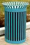
Guidelines: Site furnishings should be selected that comprise a clearly related family with respect to materials, colour, and detailing that integrate with the green slatted benches. An example of a suitable choice from catalogues is illustrated.
Lighting
Analysis: To date, there has not been a coordinated lighting strategy for the Central Experimental Farm and a variety of lighting fixtures are installed, many of which are not suited to a historic landscape. The NCC standard light fixtures along the sections of parkway within the Farm are considered appropriate in that application and should be considered for use along the entire section of Prince of Wales southward to Baseline Road if possible.
Guidelines: A coordinated and comprehensive lighting strategy is recommended on a site-wide basis both to achieve a hierarchy of lighting that makes the site more legible and attractive at night and to identify a palette of lighting fixtures for all categories of appropriate lighting needs. This lighting study should address energy efficiency to achieve sustainability and power-smart objectives set by Agriculture Canada and the Federal government in a balanced approach with heritage conservation standards.
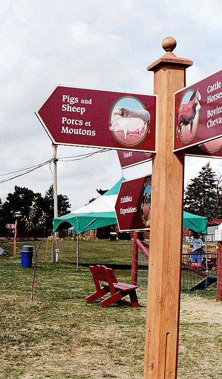
Signage
Directional Signage
Analysis: Current signage on the Central Experimental Farm is diverse and of varying condition and appropriateness. Some of the older signage will need replacement in the near future. Some of the signage is designed to the standards of federal agencies represented in buildings on site. The Museum has recently installed signs that are suited to a destination for the public and tourists but with a distinctive, contemporary look used only in that part of the site.
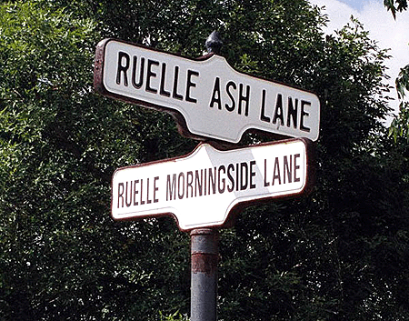
CEF Street Signage [Source: PFS]
Guidelines: Signage should be considered in light of the agricultural and research uses of the site and its importance as a cultural landscape. Signage has the potential to establish a strong, integrated character for the Central Experimental Farm, if a standard approach is adopted; a comprehensive signage program is a cost-effective strategy to achieve a coordinated landscape identity. In particular, a new design of entry and gateway signage is advocated to coordinate and unify the site at major access points, including: at the northerly end of Prince of Wales Drive, for south-bound traffic; at the southerly end of Prince of Wales Drive, for north-bound traffic; and at the northwest corner of the NCC Driveway, for southbound traffic entering from Island Park Drive. These should all relate to the driveway character of these access routes. Related gateway signage should be provided at the entrance to the research campus from Carling, and at the entrance to the Skyline headquarters complex. All of these gateways should feature a landscape and lighting treatment coordinated with the entry signage.
Agricultural Museum Signage, 2003 [Source: PFS]
It is recognized that standard federal agency signage may have a place in the identification of use for individual buildings in the core zone and the research fields. Such signage should be limited to within 15 meters of the entry to these agency buildings and should, if feasible, be restricted to wood, metal, and stone materials. Plastic and backlit signs should not be permitted. Uplighting or front lighting should be used in all cases. Installation of agency signage should, if possible be installed on a base expressed as a low stone wall and be associated with soft landscaping.

CEF Orientation Signage [Source: PFS]
Basic directional signage, such as stop signs and no parking signs, should be standardized throughout the site using a straightforward and simple graphic design. Existing street signs design should be continued (refer to photograph).
Interpretive Signage
Analysis: A number of interpretive signs have been placed on the Central Experimental Farm site (refer to photograph of an example). There are many interesting aspects of the Central Experimental Farm worthy of interpretation to its visitors.
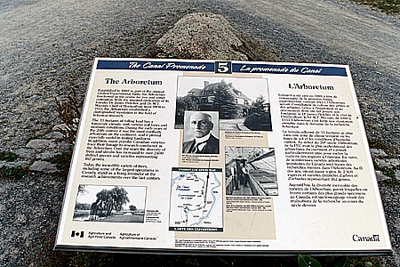
CEF Interpretive Signage, 2003 [Source: PFS]
Guidelines: A coordinated look and installation should be adopted for use in all applications for interpretive signage within the Central Experimental Farm. The identification of plant species is an important educational and historic function and should be done consistently and thoroughly in all areas where tree, hedge, and ornamental plant collections exist.
Soft Landscape
Trees
Analysis: Grand, mature trees in a remarkable range of native and exotic species are a hallmark of the Central Experimental Farm, not only in the Arboretum but also in many other parts of the core and entry zones. Recent tree planting initiatives in the Arboretum and elsewhere on site have moved away from the deliberate approach to tree selection of the past with an eye both to the research value of each specimen, and the rigour of records of its growth and condition, and to the composition of trees within a Picturesque landscape. There is a need to rationalize recent additions to the tree collection, to reconfirm the importance of record keeping and other research activities to maintaining an Arboretum, and to manage the health and plan replacement of the tree stock. Tree management has been complicated by the fact that some of the trees have been planted as memorials.

Arboretum Specimen [Source: PFS]
Guidelines: A study should be undertaken to develop a long-term tree management and research plan for the Central Experimental Farm with a focus on both the Arboretum and other areas with significant trees. This study should update existing records of the trees and their provenance and involve the stakeholder groups currently participating in stewardship activities. In the interim, there should be a moratorium on new tree planting, especially with regard to donor trees, and possible removal or relocation of recent donor trees.
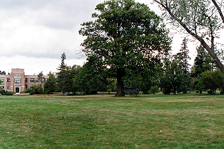
Specimen Tree in Central Green [Source: PFS]
Hedges
Analysis: Hedges, and especially the new and old hedge collections, are important landscape resources on the Farm.
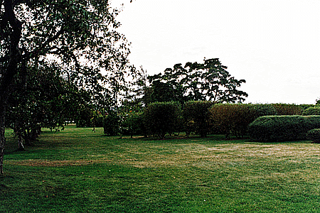
CEF Hedge Collection [Source: PFS]
Guidelines: The hedge collections should be considered as part of the recommended study on trees discussed above. Hedges are an appropriate landscape form within the entry and core zones, especially as a means to define some of the parkway corridors and specific outdoor spaces.
Shrubs
Analysis: Shrubs are plants that are in the most urgent need of rehabilitation. Many of the shrubs are old and show signs of neglect. Over the years, shrub beds have been added in places that are not consistent with the historical design concept, especially within the Arboretum, and dilute the Picturesque qualities of the landscape.
Guidelines: Shrubs should be used sparingly and selectively within the Picturesque landscape, especially in the parts of the Arboretum and Core Zone that were historically expressed as open expanses of lawn. Generally these landscapes should be comprised of areas of lawn under free-standing specimen trees and edged by paths and groupings of denser vegetation. As shrub areas in these locations require replacement, consideration should be given to returning the area to grass unless there is an overriding reason for its replacement, such as preserving a visual buffer, reinforcing a edge condition, or discouraging pedestrian movement.
Shrub Collection, Ornamental Garden [Source: PFS]
In areas of the site where a woodland design expression is historically appropriate, the selection and management of shrub understorey should consider the use of plant species that are native to Ottawa, or related cultivars, and have values as wildlife habitat.
Lawn
Analysis: Lawn is a primary component of the historic landscape character in the entry and core zones. Generally the landscape is comprised of areas of lawn under mature trees. Lawn care is labour-intensive and has typically been cut back in park and institutional landscapes over recent years due to funding constraints and limitations on water use. These trends are likely to be a continued reality. The authenticity of the Picturesque landscape suffers somewhat with reduced standards of care but is resilient enough to sustain its overall character.
Ornamental Garden [Source: PFS]
Guidelines: The use of lawn should be maintained as the dominant groundcover in the Central Experimental Farm and should be given an intermediate level of care that tolerates some weeds and browning during drought periods, except in places of high visibility such as adjacent to the front entry of important buildings.
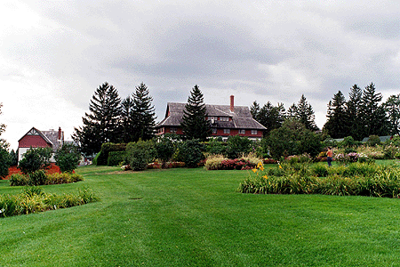
Groundcover and Flowers
Analysis: Groundcovers and flowerbeds are traditionally used around buildings, at entries, and in the Ornamental Gardens. These features are an important part of the landscape and one that is valued by the public who visit the site. These areas require high levels of maintenance that are difficult to sustain on limited budgets. Involvement of volunteers is a key strategy to sustaining these intensively cared for landscape elements when present at the scale of the Ornamental Gardens.
Guidelines: Groundcover and flowerbeds should continue to be features of the landscape around buildings in the core area and of the Ornamental Gardens. The Gardens should be restored to their historic appearance within the constraints of available staff and volunteer time and budgets.

Ornamental Garden, 2003 [Source: PFS]