
Panoramic views of the Central Experimental Farm including the Ornamental Gardens, the Dominion Arboretum, and the Research Plots and Fields of the Eastern Cereal and Oilseed Research Centre
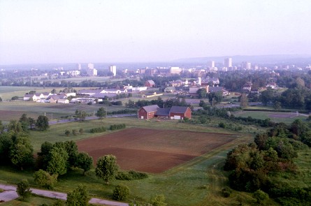


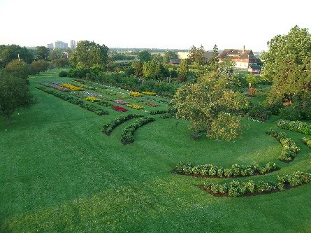

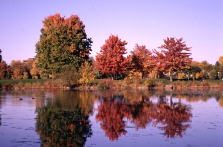

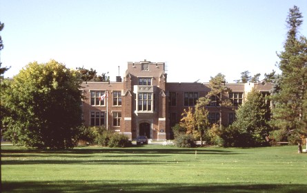


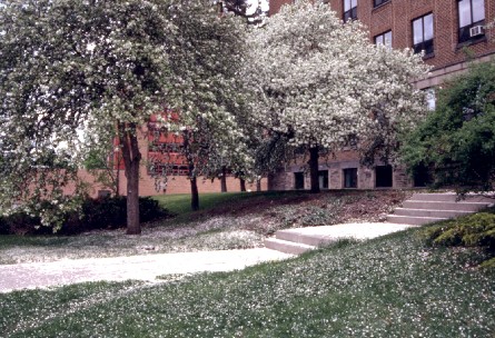


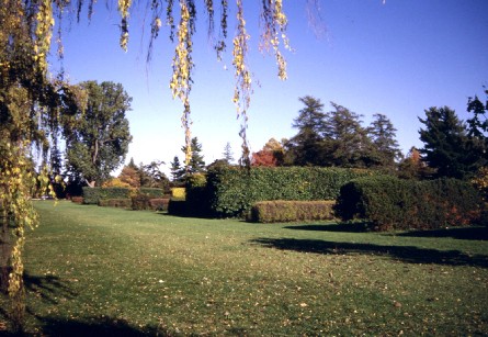
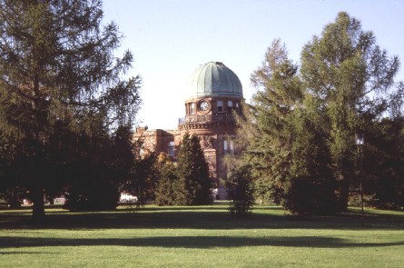


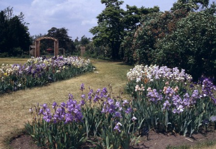


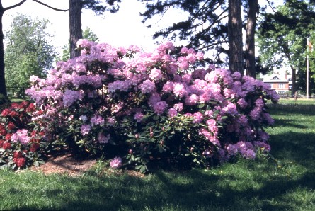
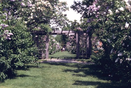
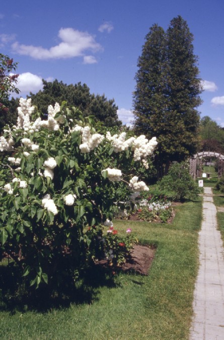


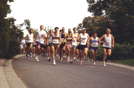
Image 1: Low-angle air photo of the Central Experimental Farm, showing the main cropping and service support facilities for the Eastern Cereal and Oilseed Research Centre in the middle of the photo.
Image 2: Low-angle air photo of CEF looking west showing research plots and field areas. The National Headquarters Complex for the Agriculture Portfolio is on the horizon - (white structures -left side).
Image 3: The National Headquarters Complex for the Agriculture Portfolio.
Image 4: General view of the CEF Ornamental Gardens.
Image 5: View of the CEF Ornamental Gardens.
Image 6: Fall panorama of colors of CEF Dominion Arboretum trees, adjacent to the Rideau Canal.
Image 7: View of two walkers enjoying early-fall tree colors in the Dominion Arboretum.
Image 8: Exterior view of the Saunders Building which is built on the site of the residence of Sir William Saunders, the founder of the Canadian Experimental Farms system in 1886.
Image 9: Exterior view of a historic CEF residence now designated as a heritage structure.
Image 10: The commemorative plaque of the Historic Sites and Monuments Board of Canada indicates the designation of the CEF as a National Historic Site in 1998. The location is at the corner of Maple Drive and the NCC Driveway.
The plaque states "A rare example of a Farm within a city, this outstanding cultural landscape brings together two strong 19th century interests: agricultural improvement and picturesque design. Established by the federal government in 1886, the Farm has supported Canadian agriculture by undertaking critical scientific research and by developing and demonstrating good farming methods. Its 426 hectares are organized into three distinct areas: a central core of science and administration buildings, an arboretum and ornamental gardens, and the experimental fields and plots. The Main Dairy Barn with its attached stables laid out around a barnyard, was at the heart of the model farm. The individual parts of the landscape are orchestrated into an organic whole intended to enhance nature's inherent beauty. Adopting picturesque features of a British country estate the Farm combines large stretches of lawn and field, winding paths and pleasing water vistas. This site is a symbol of the critical role agriculture has played in shaping Canada. / Paysage culturel exceptionnel en milieu urbain, la Ferme expérimentale centrale fait état de deux préoccupations importantes au XIXe siècle : le progrès agricole et l'aménagement pittoresque. Étabile par le gouvernement fédérale en 1886, la ferme a contribué au développement de l'agriculture grâce à d'importantes recherches scientifiques ansi que par l'élaboration et l'expérimentation de nouvelles méthodes. Les 426 hectares qui la composent sont organisés en trois composantes distinctes : l'aire centrale, qui accueille les immeubles des sciences et de l'administration, un arboretum complété par les jardins ornementaux, enfin des parcelles voisinant des champs de culture expérimentale. Le coeur de cette ferme modèle comprenait alors la grange principale réservée aux vaches laitières et des étables adjacentes réparties autour d'une cour. Dans le but de rehausser la beauté naturelle des lieux, chacune des trois composantes du paysage s'intègre en un ensemble organique. Adoptant le charactère bucolique de la campagne anglaise, la ferme incorpore aux vastes étendues de verdure et de culture des plans d'eau et des sentiers. Ce site symbolise bien l'importance de l'agriculture dans les développements du Canada."
Image 11: Located next to the National Historic Site commemorative plaque is a second historical marker which maps the lay-out of the major areas (administrative, public and experimental) on the CEF.
The plaque shows:
- Central Core of Science, Administration and Model Farm Buildings,
- Arboretum and Ornamental Gardens,
- Experimental Fields and Plots. /
- Ensemble Central des Bâtiments Scientifiques, Administratifs et de la Ferme Modèle,
- Arboretum et Jardins d'Ornement,
- Champs et Parcelles d'Expérimentation.
Image 12: View showing flowering crab apple trees at the side entrance to the KW Neatby Building.
Image 13: Low-angle air photo of CEF looking north showing wheat research plots of the Eastern Cereal and Oilseed Research Centre. The growing crop is being water-sprayed to simulate humid weather conditions and to evaluate plant resistance to mold growth.
Image 14: A view of cereal research plots for the Eastern Cereal and Oilseed Research Centre.
Image 15: View of the historic CEF hedge collection showing rows of various hedge types.
Image 16: Exterior view of the Natural Resources Canada Observatory Building located at the north end of the CEF site.
Image 17: View of grounds staff transplanting annual plants into a flower bed in the CEF Ornamental Gardens.
Image 18: View of the CEF Ornamental Gardens.
Image 19: General view of the CEF Ornamental Gardens featuring the plantings of perennials.
Image 20: Foreground shows a row of spirea in full bloom. A livestock barn of the Canada Agriculture Museum is in the background.
Image 21: View of two beds of bearded irises in full bloom. A grass walkway is between the plantings. An arbour in the background marks the entrance to the Heritage Rose Garden.
Image 22: View of Hosta flower beds. Flowers and plantings of the 'Lilac Walk' are shown in the background.
Image 23: A flowering rose bush.
Image 24: View of a flowering rhododendron with pink blooms.
Image 25: View of flowering lilacs in the 'Lilac Walk' area of the Ornamental gardens. The foreground shows an arbour.
Image 26: View of one of the walkways in the CEF Ornamental Gardens with white flowering lilacs on left. An arbour which leads to the Rose Garden is shown in the background.
Image 27: View of a part of the Dominion Arboretum.
Image 28: A general view from the south lookout looking down across the lower level of the Arboretum. Several dog-walkers can be seen.
Image 29: Feeding a flock of ducks in an area of the Dominion Arboretum adjacent to the Rideau Canal.
Image 30: A group of runners on one of the Dominion Arboretum pathways.
Image 31: View of trees with fall leaf colors near the entrance to the Dominion Arboretum.
Image 32: A group of runners on the driveway at near the entrance to the Dominion Arboretum participating in a charity fund-raising event.